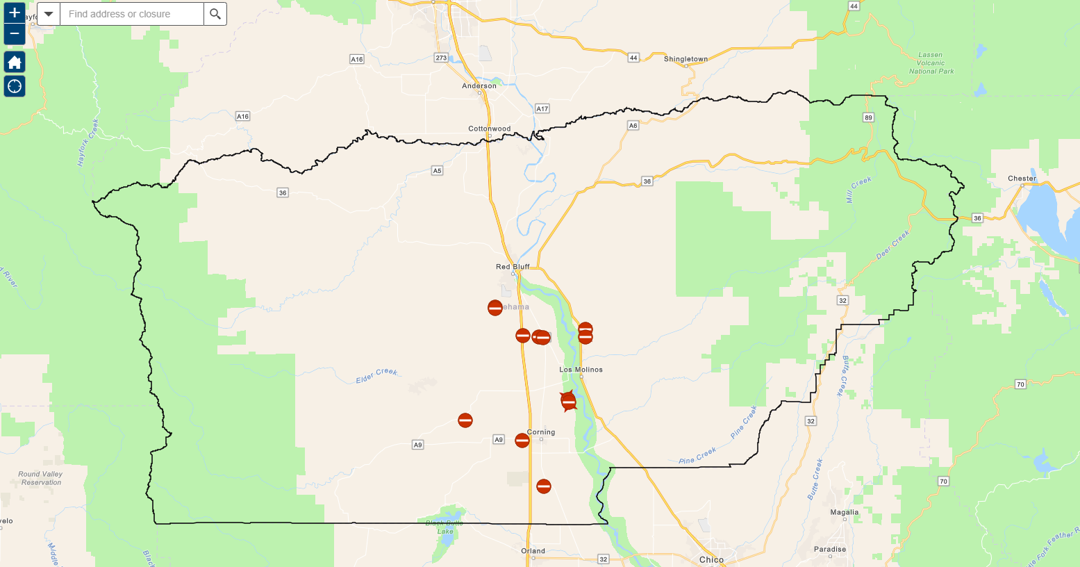
Road Closures
Road Closure Information and Updates
Road Closures and Incident Locations
View Tehama County Transportation Commission Geospatial Data interactive GIS apps, maps and dashboards.
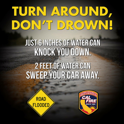
TURN AROUND, DON'T DROWN!
Just 6 inches of water can knock you down. 2 feet of water can sweep your car away.
We also recommend following our Facebook page for updates.
Disclosure
Tehama County provides this information on an “as is" basis. The County reserves the right to make changes and updates to the information at any time and without notice. Any person or entity who relies on information contained herein does so at their own risk.
Tehama County Road Closures
UPDATE****** 6/16/26
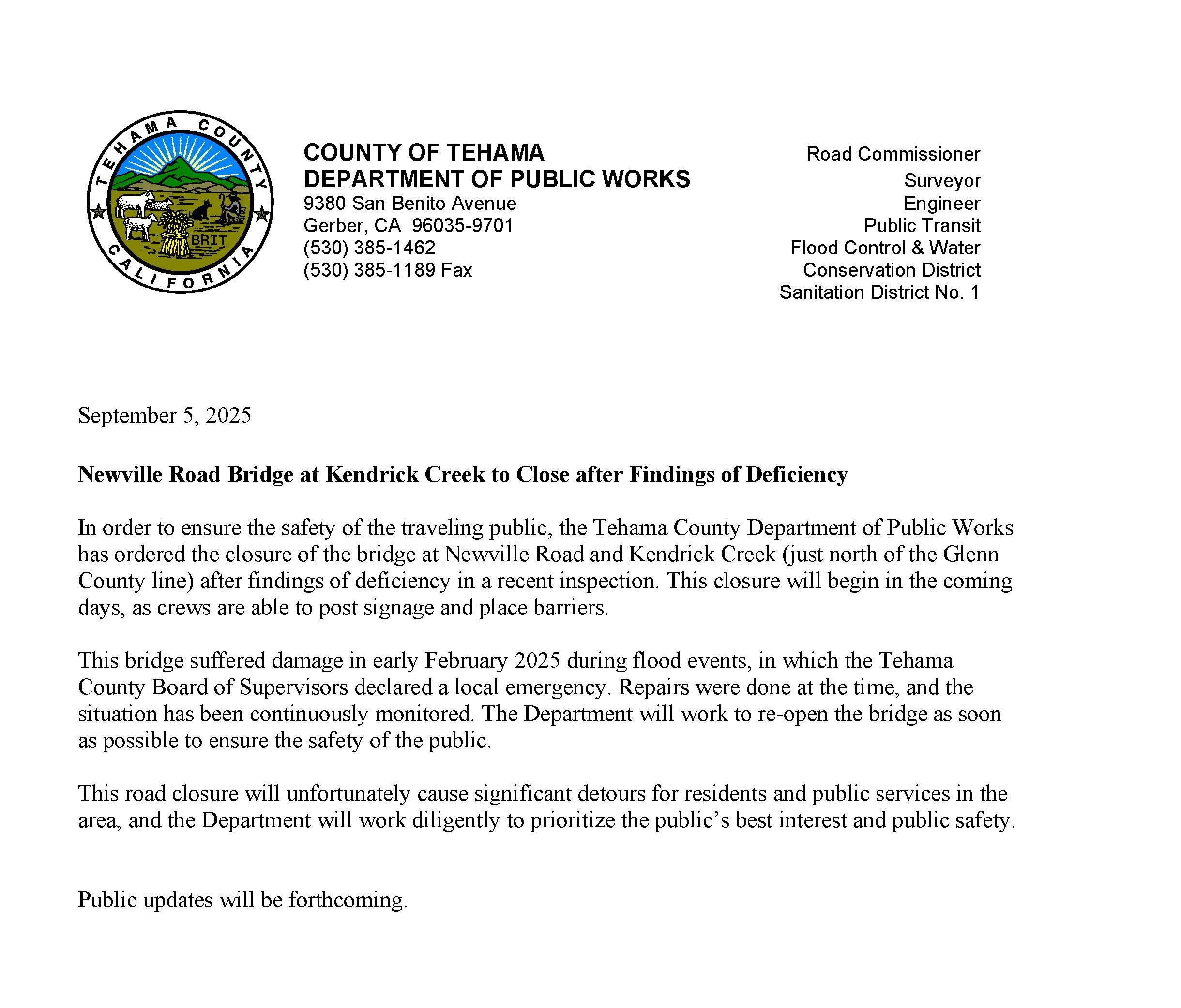
NEWVILLE ROAD AT KENDRICK CREEK IS OFFICIALLY FULLY OPEN FOLLOWING BOARD APPROVAL AT THIS MORNING’S BOARD MEETING. PLEASE FOLLOW POSTED SIGNAGE AT AND ON THE SINGLE LANE BRIDGE AT KENDRICK CREEK. THANK YOU FOR YOUR PATIENCE DURING THE PERIOD OF CLOSURE.
************
UPDATE****** 12/17/2025
On Tuesday Public Works presented options to the board of supervisors and received approval to move forward for re-opening and repairs to the bridge on newville Road over the kendrick creek crossing. updates and timeline will be posted as information becomes available.
UPDATE******10/1/2025
The Newville Rd. over Kendrick Creek bridge remains closed in the interest of public safety per an order by Caltrans. We are working diligently to seek a solution to mitigate the issues.
Please continue to use the posted alternate routes.
It is not advised to breach the barricades.
************
THIS IS AN OFFICIAL NOTIFICATION:
EFFECTIVE: 9/8/25 4:20PM
NEWVILLE ROAD IS CLOSED AT THE BRIDGE FOR THE KENDRICK CREEK CROSSING DUE TO STRUCTURAL DEFICIENCIES. PLEASE SEEK ALTERNATE ROUTES.
District A Road Closures:
- Paskenta Rd is closed at the Red Bank Creek wet crossing
District C Road Closures:
- Hall Rd wet crossing 1.9 miles south of Gyle Rd. due to flooding
- Flournoy Ave. is closed between Kirkwood Rd. and Marguerite Ave. due to the structural damage of a bridge
- North on Kirkwood Rd
- East on Viola Ave
- South on Marguerite back to Flournoy Ave